
News + Events
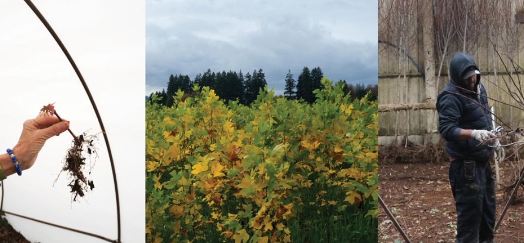
Before a Plant Arrives on Site
Landscape designer and researcher Leah Kahler has been appointed the 2024-2025 McHarg Fellow in the Department of Landscape Architecture at the Weitzman School. Kahler is a landscape designer and researcher whose work is motivated by justice-oriented storytelling though the lens of landscape. Her research explores the socioecological legacies of the plantation landscape, focused on sites of labor, extraction, and production in the American South.
Kahler received a Master of Landscape Architecture from the University of Virginia, where her research as a Benjamin C. Howland fellow explored the possibilities of an abolition ecology through speculative fiction at the site currently known as the Louisiana State Penitentiary. She was a 2021 Landscape Architecture Foundation Olmsted Scholar finalist, and she received the LAF Honor Scholarship in Memory of Joe Lalli, FASLA.
Kahler joins Weitzman from Reed Hilderbrand's practice in Boston, where she played a key role in the design and construction of a 24-acre public park on the Tennessee River in Knoxville. Kahler has also taught landscape architectural representation at Boston Architectural College. No stranger to Philadelphia, she holds a Bachelor of Arts in Anthropology and the Growth and Structure of Cities from Bryn Mawr College.
Housed in the Department of Landscape Architecture at Weitzman, The McHarg Center was founded in 2017 as an interdisciplinary platform for faculty research, teaching, and advocacy supporting the future of our planet.

Greetings From Earth
Join the McHarg Center for Urbanism and Ecology on Earth Day 2025 for a community conversation highlighting ongoing McHarg Center-supported faculty research from the perspective of Department of Landscape Architecture faculty and their student research assistants. This year-end celebratory event will take place on Tuesday, April 22 at 6:30pm in the Kleinman Center at the Fisher Fine Arts Library, and will feature an interactive panel discussion with three faculty/student research teams.
Please join us for delicious planet-conscious refreshments, and bring your voice to the conversation!

2025-2026 McHarg Fellow Announced
The McHarg Center for Urbanism and Ecology is thrilled to announce the selection of the 2025-2026 McHarg Fellow, Tami Banh!
Tami is a Vietnamese architect and landscape architect based in New York City. Her work explores ways of restructuring relationships between people and the environment through design, building, writing, and making. Focused on critical representation, climate resilience, and human / more-than-human cohabitation, her research and practice engage with landscapes at the intersection of ecology, infrastructure, and community resilience.
Tami’s current research project, “Shared Waters, Divided Landscapes,” explores how cultural landscapes, governance frameworks, and ecological practices shape the Mekong River across national boundaries, examining how policies, traditional knowledge, and representations of the river influence its physical and cultural transformations. Through field and archival research, comparative study, and community engagement, the work explores alternative frameworks for understanding and designing within contested and dynamic waterscapes.
Previously, as an Associate at SCAPE Landscape Architecture, Tami has led and supported public landscape infrastructure projects that integrate placemaking, ecological design, and social impact such as Living Breakwaters and Hudson Highlands Fjord Trail. She also served as an Associate Adjunct Professor in the Urban Design program at Columbia University and has worked at SHoP and ZGF Architects. Tami holds a Bachelor of Architecture from the University of Southern California and a Master of Architecture and Master of Landscape Architecture with Distinction from Harvard University’s Graduate School of Design.
Tami will follow our exceptional 2024-2025 McHarg Fellow, Leah Kahler, who will present the culmination of a year of teaching and research on Thursday, April 24 at 6.30pm in the Upper Gallery of Meyerson Hall. Leah’s research and spring seminar “Clones, Zones, and Migrants” explore the socioecological legacies and implications of the plantation landscape and the American nursery industry, focused on sites of labor, extraction, and production.
We’re looking forward to the year ahead as Tami Banh joins the Weitzman community and as Leah Kahler moves on to her next exciting chapter!
McHarg Fellowship
The McHarg Fellowship is a teaching and research award given by the McHarg Center for Urbanism and Ecology to an emerging voice in landscape architecture.
The Fellowship is awarded competitively on an annual basis and the selected fellow is expected to be in residence at the University of Pennsylvania, in Philadelphia, full-time for one academic year.
The purpose of the Fellowship is to create a unique opportunity for an emerging professional and/or academic who would benefit most from support to conduct research, to teach, and to be mentored by faculty during the term of the Fellowship.
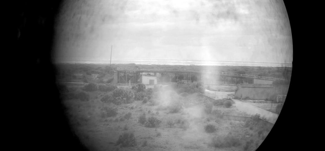
Ground Control: Technical Lands for Departing Earth
Jeffrey S Nesbit is an architect, urbanist, founding director of the research group Grounding Design. His work focuses on processes of urbanization, infrastructure, and the evolution of "technical lands." His experience spanning over a decade includes leading design teams for public architecture and large-scale urban projects, along with leading sponsored design research projects for city governments, local institutions, and NGOs. He is author of several books on infrastructure and urbanization, including Ground Control: A Design History of Technical Lands and NASA’s Space Complex (Routledge, 2024), Technical Lands: A Critical Primer (Jovis, 2023), and Nature of Enclosure (Actar, 2022). Nesbit is currently assistant professor in history and theory of architecture and urbanism in the Tyler School of Art and Architecture at Temple University.

Architectures and Ecologies of Amazonia
Architectures and Ecologies of Amazonia is an interdisciplinary international symposium and exhibition highlighting the agencies that have shaped and are shaped by Amazonia. Threatened by deforestation, fire, and drought, the Amazon rainforest, which spans nine countries, is home to more than thirty million people. It is the ancestral homeland of more than one million Indigenous peoples and supports the greatest concentration of biodiversity on Earth. In the face of the widespread socio-environmental challenges we currently face, along with the existential threat of crossing the environmental tipping point of the Amazon rainforest, the symposium aims to share lessons that the study of the Amazon can teach us about climate action, coexistence, and the built environment.
The symposium was organized by Vanessa Grossman, Assistant Professor, Department of Architecture, and Catherine Seavitt, Meyerson Professor of Urbanism and Chair, Department of Landscape Architecture, in collaboration with Fernando Lara, Professor, Department of Architecture and Kristina Lyons, Associate Professor of Anthropology. A parallel exhibition of student work is on display in the Mezzanine Gallery of Meyerson Hall through May 1, 2025. The exhibition is designed by Jonathan Bonezzi and Ryan Lane Thomas.
Architectures and Ecologies of Amazonia is co-hosted by the Department of Architecture, the Department of Landscape Architecture, and the McHarg Center for Urbanism and Ecology. The symposium also received generous support from several programs and initiatives across the University, including the Perry World House International Visitors Grant Program, the Department of Anthropology, the Center for Experimental Ethnography, the Center for Latin American and Latinx Studies, and Native American and Indigenous Studies at Penn.
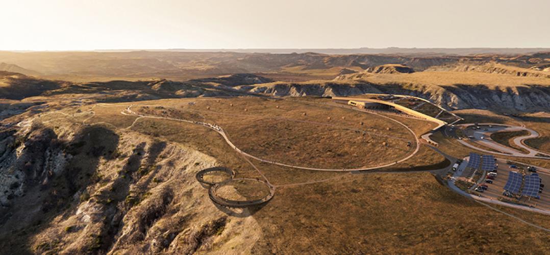
The Anne Whiston Spirn Lecture: Michelle Delk, “Snøhetta Landscapes”
Michelle Delk, the Laurie Olin Professor of Practice in Landscape Architecture at Penn and partner with Snøhetta in New York City, will deliver the inaugural Anne Whiston Spirn Lecture. Delk’s lecture, Snøhetta Landscapes, will focus on her recent work with the firm, where she leads the landscape architecture practice in the Americas.
Delk’s work is evocative of a foundational premise shared with Snøhetta: to create places that enhance the positive relationships between people and their environments. Both aspirational and pragmatic, she seeks to discover and expand the urban landscape vernacular, striving to express the subtleties of place through the incongruities of memory, envi¬ronment, and social perceptions. Delk is a Fellow with the American Society of Landscape Architects, a board member with New York’s Urban Design Forum, and a member of the Cultural Landscape Foundation Stewardship Council.
The Anne Whiston Spirn Lecture is presented annually by The Ian L. McHarg Center for Urbanism and Ecology to showcase a practitioner or scholar in the field of landscape architecture whose work expands the disciplinary boundaries of research and practice. Housed in the Department of Landscape Architecture at the University of Pennsylvania Stuart Weitzman School of Design, The McHarg Center was launched in 2019 as a transdisciplinary platform for collaborative research supporting the future of life on Earth. The lecture honors Anne Whiston Spirn (MLA’74), a Penn alumna who led the Department of Landscape Architecture as chair from 1986-1994 and whose work inspires deeper engagements with people and planet.
Thursday, February 6, 2025
6:30 pm - 8:00 pm
Kleinman Energy Forum, Fisher Fine Arts Library, 4th Floor, 220 South 34th Street, Philadelphia
If you require any accessibility accommodation, such as live captioning, audio description, or a sign language interpreter, please email news@design.upenn.edu. Please note, we require at least five (5) business days’ notice.

Popowsky Named Wilks Family Director at McHarg Center
We are very excited to share the news that award-winning landscape architect, researcher, and educator Rebecca Popowsky has been named the Wilks Family Director of The McHarg Center, effective January 1.
Rebecca has a long history with Penn, having earned her MLA and MArch degrees here in 2010. She most recently served as a research associate and the OLIN Labs coordinator at the internationally renowned landscape architecture firm OLIN, where she co-led its internal research practice since 2018. Developing innovations in waste-based material design and construction, soils engineering, and practice-based research models, she established partnerships in the public, private, nonprofit, and academic sectors. In her capacity as landscape designer at OLIN, Rebecca contributed to a wide range of design, planning, and construction projects. She joined the Penn faculty in 2015 and has taught core and advanced design studios and professional practice courses in the Department of Landscape Architecture. Rebecca succeeds Billy Fleming, who was instrumental in conceiving and producing many of the Center’s public programs and contributed to numerous research initiatives, including as co-editor of Design with Nature Now, which was recently published in Chinese and traditional Chinese translations. Billy has been appointed assistant professor of landscape architecture in the Tyler School of Art and Architecture at Temple University, where he joins several other Penn alumni on the faculty there.

Stream 'Landscape Futures' on YouTube
On September 27 and 28, 2024, the Department of Landscape Architecture presented Landscape Futures: Centennial of the Department of Landscape Architecture. The program included keynotes from James Corner (MLA’86) and Anne Whiston Spirn (MLA’74), as well as three panels moderated by landscape architecture faculty, all of which can be streamed on YouTube.
The Naturalist
With Jared Farmer, Sally Willig, Tessa Lowinske Desmond
Moderated by Sean Burkholder Jared Farmer, PhD, is the Walter H. Annenberg Professor of History at the University of Pennsylvania’s School of Arts and Sciences. Sally Willig, PhD, is a lecturer and program advisor in the Master of Environmental Studies program at the University of Pennsylvania’s College of Liberal and Professional Studies and Weitzman’s Department of Landscape Architecture. Tessa Lowinske Desmond is a research specialist in the School of Public and International Affairs at Princeton University, where she directs The Seed Farm at Princeton. Sean Burkholder is the Andrew Gordon Assistant Professor of Landscape Architecture at the Weitzman School of Design.
The Astronaut
With M. Christine Boyer (MS’64), Andrew Zolli , Alvin D. Harvey
Moderated by Azzurra Cox
M. Christine Boyer, PhD, is the William R. Kenan, Jr. Professor of Architecture and Urbanism at Princeton University’s School of Architecture, where she directs the undergraduate urban studies certificate program. Andrew Zolli is Chief Impact Officer at Planet, a space and AI organization that has deployed the largest constellation of Earth-observing satellites in history. Alvin D. Harvey, PhD, is Diné of the Navajo Nation and a postdoctoral fellow at MIT’s Department of Aeronautics and Astronautics, with a focus on Indigenous Research Methodologies and Methods. Azzurra Cox is an assistant professor of landscape architecture at the Weitzman School of Design.
The Household of Nature
With Sonja Dümpelmann, Lydia Kallipoliti, Rob Holmes
Moderated by Nicholas Pevzner (MLA’09)
Sonja Dümpelmann is Professor and Chair of Environmental Humanities at the Ludwig Maximilian University of Munich, where she co-directs the Rachel Carson Center for Environment and Society. Lydia Kallipoliti is an associate professor and director of the Master of Science in Advanced Architectural Design program at Columbia University’s Graduate School of Architecture, Planning, and Preservation. Rob Holmes is an associate professor and chair of the undergraduate landscape architecture program at Auburn University, where he leads the Landscape Infrastructure Design Lab. Nicholas Pevzner is an assistant professor of landscape architecture at the Weitzman School of Design.
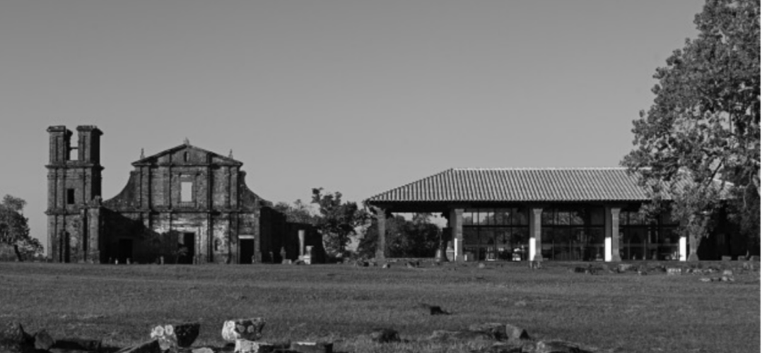
"Essential Documentation." Adaptive Reuse in Latin America: Cultural Identity, Values and Memory
Adaptive reuse in Latin America in 2023 is a practice that focuses on preserving cultural identity, values, and memory through the renovation and repurposing of historical buildings and structures. This approach aims to maintain a strong connection to the region's rich cultural heritage and traditions while promoting sustainability and economic development. It involves converting old, often neglected buildings into new, functional spaces, such as museums, community centers, or housing, which celebrate and preserve the history and identity of the area. Adaptive reuse is a means of breathing new life into architectural gems, keeping them relevant for future generations, and maintaining a sense of cultural continuity in the rapidly changing urban landscapes of Latin America.
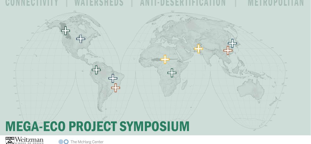
MEGA-ECO: A Symposium on Very Large-Scale Landscape Projects
For nearly a century, a new breed of landscape infrastructure megaproject has gone unrecognized, and is now proliferating, according to the organizers of a public symposium at the University of Pennsylvania Stuart Weitzman School of Design set for October 5, 2023. These projects are designed to address biodiversity loss, land degradation, and climate change while improving living conditions for the Earth’s eight billion human inhabitants. Representing trillions of dollars in potential investments, can they deliver the ecological transformation they promise?
MEGA-ECO: A Symposium on Very Large-Scale Landscape Projects brings together designers and land managers for ecological restoration megaprojects in China, Pakistan, Brazil, Africa, Korea, Saudi Arabia, Canada, and the US to explore cross-border approaches to connectivity, anti-desertification, watersheds, and metropolitan development. They include representatives of the World Wildlife Fund, the International Union for the Conservation of Nature, and the Center for Large Landscape Conservation, among others, who will discuss the Four Major Rivers Restoration Project (China); Forest Conservation in the Heart of the Colombian Amazon; Great Green Wall Initiative (Africa); São Paulo Greenbelt and Biosphere Reserve (Brazil); Sponge Cities Initiative (China); Upper Mississippi River Restoration Program (US); Upscaling Green Pakistan; and Yellowstone to Yukon (North America).
The program opens with a keynote talk by author Tony Hiss, co-creator of the half-earth movement (50x50) and visiting scholar at the Wagner School of Public Service, New York University.
The symposium is organized into four sessions, with presentations from each project representative followed by a discussion with expert panelists:
- Keith Bowers, Landscape Architect and Founder, Biohabitats
- Dr. Gary Tabor, Founder and Director, Center for Large Landscape Conservation
- Dr. Emmanuelle Cohen-Shachem, Nature-based Solutions, Thematic Lead, International Union for Conservation of Nature
- David Kuhn, Lead, Corporate Resilience, World Wildlife Fund
- Tyra Northwest, Traditional Land Use Lead, Samson Cree Nation, and co-founder, International Buffalo Relations Institute
Panel 1: Connectivity
- Dr. Jodi Hilty, Chief Scientist and President, Yellowstone to Yukon (Y2Y)
- Dominique Bikaba, Founding Member and Executive Director, Strong Roots Gorilla Corridor
- Ana Maria Gonzalez Velosa, Amazon Sustainable Landscapes Program Coordinator: Team leader, World Bank
- Andrea Fernanda Calderón, Technical Liaison of the Natural Heritage Project, North East Amazon Environmental and Sustainable Development Corporation (CDA), Proyecto Corazón de la Amazonia
Panel 2: Anti-Desertification
- Dr. Elvis Paul Nfor Tangem, Coordinator of the Great Green Wall Initiative
- Faiz Ali Khan, National Director, Upscaling Green Pakistan (formerly the Ten Billion Tree Tsunami Programme)
Panel 3: Watersheds
- Ben Valks, Creator/Visionary of the Araguaia Biodiversity Corridor
- Marshall Plumley, Regional Program Manager, Upper Mississippi River Restoration Program
- Yongjun Jo, Landscape Architect
Panel 4: Metropolitan Projects
- Hexing Chang, Associate Principal, Turenscape
- Rodrigo Victor, Professor, University of São Paulo
Concluding remarks will be delivered by Matthijs Bouw, Associate Professor of Practice at the Weitzman School of Design.
MEGA-ECO is presented by The Ian L. McHarg Center for Urbanism and Ecology and Penn Global, and is organized by Rob Levinthal, PhD candidate in the Department of City & Regional Planning, and Richard Weller, professor of landscape architecture.
MEGA-ECO builds on the 2019 publication Design With Nature Now, a re-assessment of the legacy of Ian McHarg’s landmark 1969 book Design With Nature which was co-edited by Weller along with Penn faculty members Frederick Steiner, dean and Paley Professor; Karen M’Closkey, associate professor of landscape architecture; and Billy Fleming, Wilks Family Director at The McHarg Center.
The public symposium on October 5 is followed by an invite-only roundtable on October 6. Admission to the symposium is free and open to the public with advance registration.
Link to register: https://www.eventbrite.com/e/mega-eco-project-symposium-tickets-7087385…