News + Events
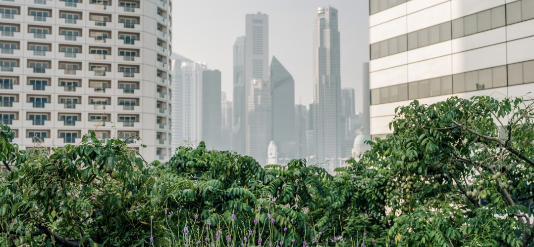
Denser and greener cities: Green interventions to achieve both urban density and nature.
- Green spaces in urban areas—like remnant habitat, parks, constructed wetlands, and street trees—supply multiple benefits.
- Many studies show green spaces in and near urban areas play important roles harbouring biodiversity and promoting human well-being. On the other hand, evidence suggests that greater human population density enables compact, low-carbon cities that spare habitat conversion at the fringes of expanding urban areas, while also allowing more walkable and livable cities. How then can urban areas have abundant green spaces as well as density?
- In this paper, we review the empirical evidence for the relationships between urban density, nature, and sustainability. We also present a quantitative analysis of data on urban tree canopy cover and open space for United States large urbanized areas, as well as an analysis of non-US Functional Urban Areas in OECD countries.
- We found that there is a negative correlation between population density and these green spaces. For Functional Urban Areas in the OECD, a 10% increase in density is associated with a 2.9% decline in tree cover. We argue that there are competing trade-offs between the benefits of density for sustainability and the benefits of nature for human well-being. Planners must decide an appropriate density by choosing where to be on this trade-off curve, taking into account city-specific urban planning goals and context.
- However, while the negative correlation between population density and tree cover is modest at the level of US urbanized areas (R2 = 0.22), it is weak at the US Census block level (R2 = 0.05), showing that there are significant brightspots, neighbourhoods that manage to have more tree canopy than would be expected based upon their level of density. We then describe techniques for how urban planners and designers can create more brightspots, identifying a typology of urban forms and listing green interventions appropriate for each form. We also analyse policies that enable these green interventions illustrating them with the case studies of Curitiba and Singapore.
- We conclude that while there are tensions between density and urban green spaces, an urban world that is both green and dense is possible, if society chooses to take advantage of the available green interventions and create it.
Reflective socio-ecological practice
This autobiographical reflection traces my work in land suitability analysis and plan-making. The suitability practice has resulted in two rating systems: the U.S. Department of Agriculture’s Land Evaluation and Site Assessment System and Green Business Certification Inc.’s SITES Rating System. Plans have been made for US counties, cities, and towns; Italian provinces; regions and watersheds; and university campuses. My practice is grounded in human ecology. I have attempted to address the issues people face with an especial focus on environmental quality and social equity. Examples of work from Ohio, Pennsylvania, Washington, Idaho, Colorado, Arizona, and Texas in the United States as well as Italy and Mexico are noted. I explore how reflection, often with collaborators and students, has informed my practice and how it can help advance the fields of planning and landscape architecture.
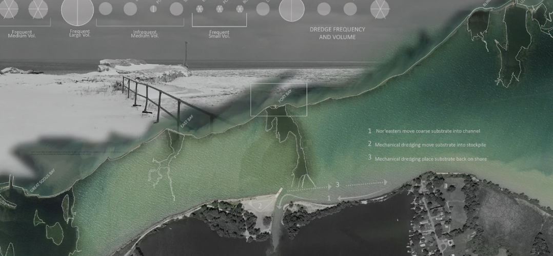
Developing and monitoring an innovative NNBF to nourish a bay bar: An example from the southeast shore of Lake Ontario
This project tests a cost-effective, innovative dredged sediment placement technique targeted to nourish an eroded barrier bar. The dredged sediment was placed in the nearshore in a Cobble Bell, a form designed to allow for efficient dispersal and migration of sediment by natural processes in this location (such as predominant waves and longshore transport) in a desired direction along the bar. We describe the regional and site assessment undertaken, and explain the way design parameters including technical feasibility, assumptions about wave climate, and constructability were accounted for. A monitoring protocol was designed and implemented to measure the vertical and horizontal accretion on the barrier bar. This included survey transects using RTK equipment and surface analysis of beach volume and morphology change via drone images and photogrammetry. Field measurements of the bar indicated that within the first few days, the piled material eroded rapidly, and over the next few months, migrated downshore, widening the previously breached area. This suggests that the cobble bell nature-based feature has the potential to both accelerate and slow down natural processes in ways that enhance the performance and attractiveness of the beach while minimizing costs. In addition to the monitoring results, we describe a monitoring protocol that is both simple and effective which can be adapted by local entities interested in the management of their coastal landscapes.
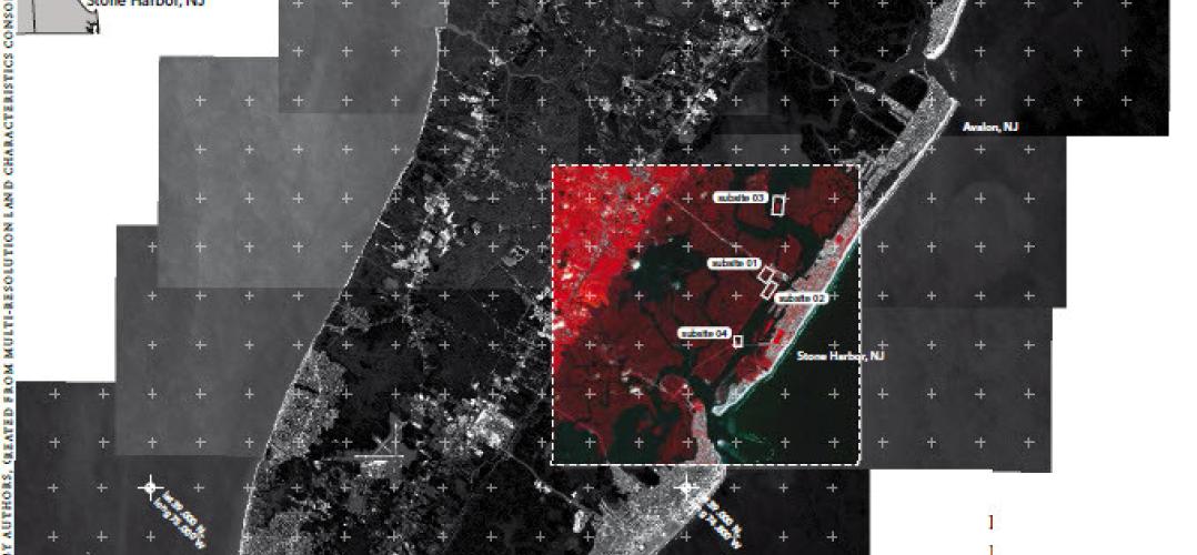
Behind-the-Scenes: Multispectral imagery and land cover classification
This article focuses on the use of remotely sensed multispectral imagery for land cover classification, a process that landscape architects may know little about but that underpins many of the maps that they use as the basis for their designs. The relatively arbitrary nature of classification, and the homogenization that occurs when classifying multispectral imagery to create land cover maps, is especially consequential when distinguishing between land and water. Yet ‘finding’ water is a key step in land cover classification. The salt marshes surrounding the Wetlands Institute in Stone Harbor, New Jersey, USA are used as a case study for multispectral analysis that combines satellite imagery with on-site surveying. However, the implications of the digital survey methods extend beyond any particular site and point to broader questions about the role of image interpretation for understanding how landscapes and environments are changing, especially with growing uncertainty about the rate of climate change.

Field Notes Towards an Internationalist Green New Deal
The McHarg Center's Climate Policy Research Group has published Field Notes Towards an International Green New Deal. This three year digital project was produced by RAs Palak Agarwal, Selina Cheah, Yixin (April) Wei, Ian Dillon, Zane Griffin Talley Cooper, A.L. McCullough, and the Wilks Family Director, Billy Fleming. Field Notes ask what it might mean for the rest of the world if the US realizes an eco modernist vision for the energy transition.
Design with Nature in Town and City
In November 2020, the Glasgow Urban Lab at the Mackintosh School of Architecture, the Weitzman School of Design at UPenn, the Landscape Institute, and the Academy of Urbanism came together to celebrate the 100th birthday of one of landscape architecture's and Scotland's pioneers of urban ecology -- Ian McHarg. A symposium was held to look at McHarg's influence, with eyes on the future.
This publication, edited by the Glasgow Urban Lab's Brian Evans and Rachel Howlett, seeks to capture some of the event's essence.
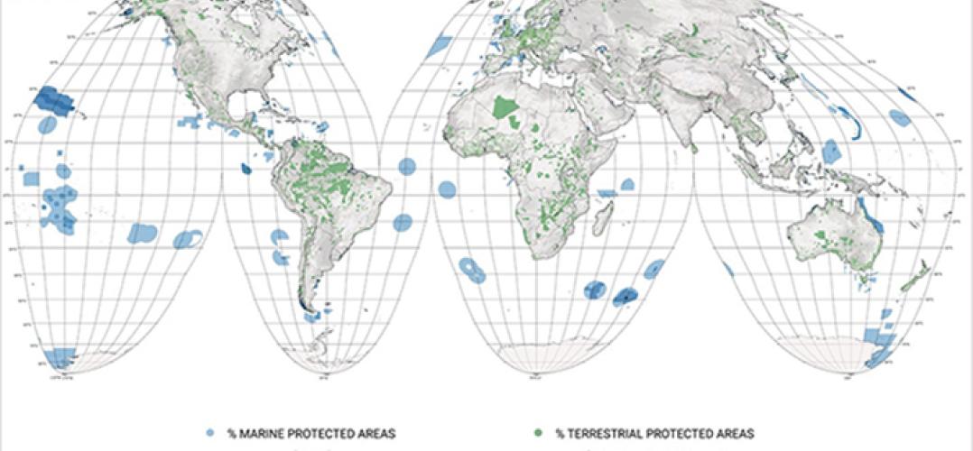
Earth Day Interview with Richard Weller: A Hopeful Vision for Global Conservation
Later this year, the parties to the Convention on Biological Diversity (CBD) will meet in China to finalize what is being called a “Paris Agreement for Nature.” The agreement will outline global goals for ecosystem conservation and restoration for the next decade, which may include preserving 30 percent of lands, coastal areas, and oceans by 2030. Goals could also include restoring one-fifth of the world’s degraded ecosystems and cutting billions in subsidies that hurt the environment. What are the top three things planning and design professions can do to help local, state, and national governments worldwide achieve these goals?
The McHarg Center's Richard Weller's answer -- Design, Design, and Design!
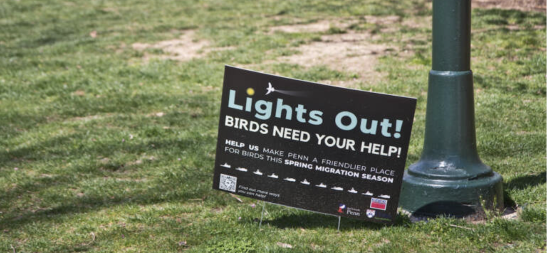
Turn out your lights to help save birds migrating through Philly
It’s spring migration season, which means millions of birds could make their way through Philadelphia in the coming weeks. Some could get hurt or die crashing into buildings — but you can help keep them safe, just by turning out your lights.
“Everyone’s home matters,” said Keith Russell, program manager for Urban Conservation with Audubon Mid-Atlantic. “Every commercial building, industrial building, every high-rise.”
The McHarg Biodiversity research group's bird safety banners are featured on WHYY!
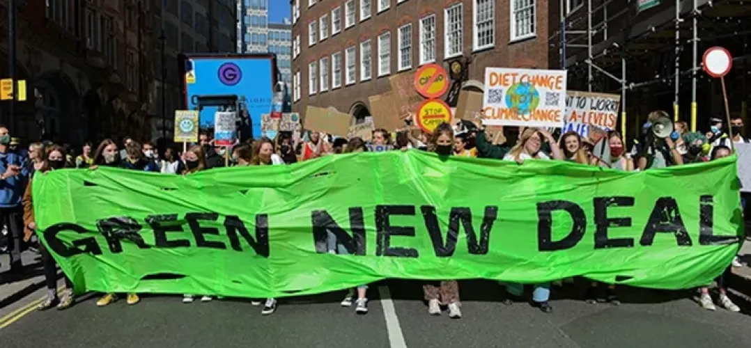
The Green New Deal Superstudio: Designing the Impossible
The McHarg Center's Richard Weller writes a critically reflects on the Green New Deal Suprtstudio in an article for the ASLA's The Dirt.
"There are two reasons why Superstudio was a good name for an event that would build on the momentum already established by Billy Fleming, ASLA, at the University of Pennsylvania, Kate Orff, FASLA, founder of SCAPE, and Thaddeus Pawlowski at Columbia University to align landscape architecture with the Green New Deal (GND). The first is that with the Landscape Architecture Foundation (LAF), back in 2020, we had all agreed to launch what was literally a supersized international design studio on the hot topic of the GND. The second reason was that Superstudio also recalls the eponymous Italian architecture group of the late 1960’s that specialized in bombastic imagery and anti-capitalist, anti-design rhetoric. This connection was, for me at least, most important because it signaled that the event we were planning was about design culture, not just political culture. The Superstudio is in this way situated as part of a certain modern tradition of speculation, which in turn provides context for the critical evaluation of its meaning..."

What If Joe Biden Paid You to Get Out of Your Car?
A new report published on Monday, co-authored by The McHarg Center's Billy Fleming, lays out a framework for dramatically decarbonizing America by 2030.